The weather was disastrous last fall and winter for the Tri-Counties and Southern California.
The Mountain Fire roared through Ventura County 11 months ago, burning nearly 20,000 acres of land and destroying 370 structures. It was followed two months later by the Palisades and Eaton Fires, which claimed dozens of lives and thousands of homes.
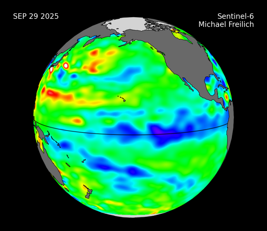
The weather was at the heart of the fires. Extreme wind, yes. But also a lack of rain. We experienced a mild La Niña condition in the Pacific, a setup that contributed to rainfall levels well below normal.
What about this year?
Climatologists are forecasting a 71% chance of another La Niña this fall, which could lead to more drought conditions and potentially higher-than-normal wildfire danger.
"She's back. The diva of drought, La Niña, has shown up in the Pacific," said Bill Patzert, research scientist and oceanographer with NASA’s Jet Propulsion Laboratory. He’s considered to be one of the world’s leading experts on El Niño and La Niña patterns.
"As we move into this fall and winter, what we certainly don't need is more drought," said Patzert. "But this drought looks like it's going to continue through the winter of 2025 and 2026. Remember last winter? It was so dry for so long, we experienced these devastating fires."
While the latest data suggests that a La Niña may impact us, it remains unclear whether it will be a weak or moderate one.
"It's definitely starting to intensify in the equatorial Pacific," said Patzert. "It's a little late for an intense La Niña. But, even a modest, or even a weak La Niña can have a big impact on weather patterns across North America."
Patzert believes that what we’re also seeing is the impacts of climate change. He said rainfall seasons are becoming more compressed.
"Our normal seasonal pattern here is that it's wet for about three or four months of the year, and it's usually dry for about seven or eight months of the year," said Patzert. "With a warming climate, what we see is that rainfall tends to come later and end earlier. So, the wet season is compressing, and the dry season is expanding. The conditions for fire all across the American West have increased dramatically over the last few decades."
Patzert added that it’s not just how much rain we get that counts, but it’s when we get it. He predicted that the best-case scenario is that we get a series of spaced-out storms over the next few months. So, even if rainfall is below normal again, if it’s spread out, and any potential fuels are damp enough, we won’t see another round of major wildfires this season.
However, Patzert said that while we should hope for the best, we need to prepare for the worst, including taking steps such as ensuring we’ve done everything possible to maximize our wildfire preparedness.


